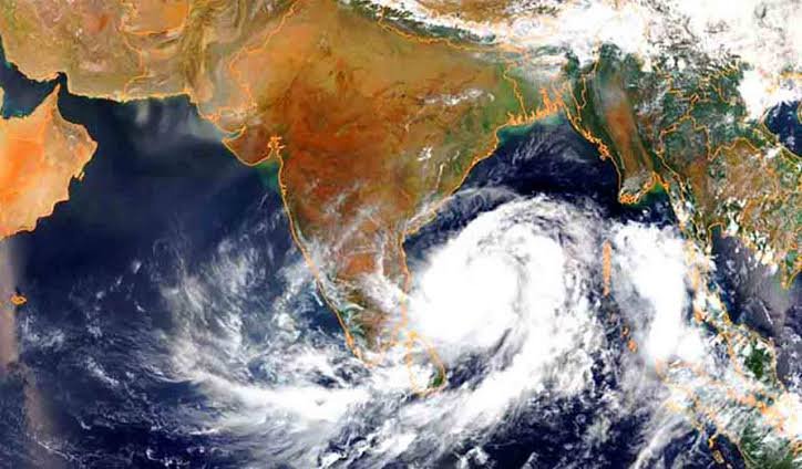
NEW DELHI, November 16 (Aalimi Nation) – A deep depression over the Bay of Bengal is forecast to intensify into a cyclonic storm on Monday evening and head towards the Andhra Pradesh coast, the India Meteorological Department (IMD) said, issuing a pre-cyclone watch for Andhra Pradesh and the adjoining south Odisha coast.
According to IMD National Bulletin No. 6, issued at 5:30 am on Monday, the deep depression was moving north-northwestwards at about 8 kmph over the southeast and adjoining southwest Bay of Bengal. At that hour it was about 720 km east-southeast of Chennai, 820 km south-southeast of Visakhapatnam and 940 km south of Gopalpur in Odisha.
The weather department said the system is very likely to become a cyclonic storm on Monday evening over the central south and adjoining west-central Bay of Bengal. It is expected to reach severe cyclonic storm strength over the west-central Bay of Bengal by Tuesday evening, November 17.
The bulletin said the system could intensify further into a very severe cyclonic storm by the night of November 19, move northwestwards and approach the Andhra Pradesh coast over the west-central Bay of Bengal. The IMD's outlook indicates that landfall is expected between northern Tamil Nadu and southern Andhra Pradesh, though the exact point and time have not been fixed and will depend on the storm's intensity and track.
Coastal districts of Andhra Pradesh have been asked to stay under close weather watch as the system approaches. The department said rain and strong winds are likely along the coast, with the severity depending on how the system develops. Heavy rain and strong winds are also expected in Odisha from November 18.
The IMD has advised fishermen not to venture into the Andaman Sea and the southeast Bay of Bengal until Tuesday, into the southwest Bay of Bengal until Thursday, and into the central Bay of Bengal until Friday. The department has also asked shipping, port and offshore operators to review their preparedness and follow updated advisories.
For the Andaman and Nicobar Islands, thunderstorms with lightning and gusty winds are forecast over the next two to three days. Rain is expected over northern coastal districts of Tamil Nadu, Puducherry and Karaikal, with moderate rain at isolated places over the Western Ghats and southern districts from Monday.
In the 24 hours ending 8:30 am on Sunday, rain was recorded in Chengalpattu, Chennai, Kancheepuram and Kanyakumari districts, according to the weather department. No casualties or damage have been reported in connection with this system so far in the reports reviewed.
The next IMD bulletins will show whether the depression becomes a cyclonic storm on schedule and whether the forecast track shifts north or south. Residents of coastal Andhra Pradesh, Tamil Nadu and south Odisha are advised to follow official updates, particularly those of the IMD and their state disaster management authorities, as the forecast is expected to be revised through the week.