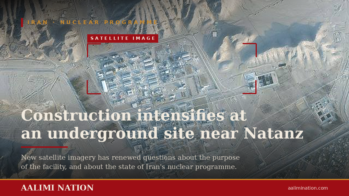
TEHRAN, September 10, 2026: Satellite imagery analyzed by a US-based research institute has revealed a significant acceleration in construction activity during 2026 at a heavily fortified site deep inside Mount Kolang, near Iran’s nuclear complex at Natanz, where Western intelligence agencies suspect Tehran may be developing an undeclared uranium-enrichment facility.
The latest imagery, captured on August 9, shows increased work to reinforce and raise tunnel entrances, expand internal road networks and clear or level excavated material around the underground complex, according to analysts at the Center for Strategic and International Studies (CSIS).
Researchers analyzed satellite images taken over a period of six years. They said the level of road and construction activity recorded at Mount Kolang during 2026 appears to be higher than at any other point since the site was established.
The imagery indicates that construction crews have been strengthening tunnel approaches, paving and improving internal roads, reinforcing areas around access routes and removing or spreading excavation debris.
However, the analysts said the imagery could not confirm whether centrifuges or other nuclear equipment had already been moved into the facility, as alleged in an Israeli intelligence assessment.
The suspected facility is located deep beneath a mountainous granite formation, making it particularly difficult to penetrate or destroy.
The location has attracted increased attention because of its potential role in Iran’s nuclear program. US President Donald Trump threatened in July to launch a major attack on the site as part of Washington’s campaign against Iran’s nuclear capabilities, although the threatened strike did not take place.
The underground location and depth of the facility could present a significant challenge to conventional military strikes, including the use of the heaviest non-nuclear weapons available to the United States.
The International Atomic Energy Agency (IAEA) has called on Iran to provide information about the Mount Kolang site and allow inspectors access to the facility.
According to reports cited by the researchers, Tehran has not complied with those requests.
The lack of access has added to international concerns over the purpose and status of the underground complex, particularly amid continuing disputes over Iran’s nuclear activities and the monitoring of its nuclear facilities.
The satellite imagery findings come as the conflict between the United States and Iran enters its seventh month, with tensions continuing to escalate across the Middle East.
Iran launched fresh attacks against US targets in the region on Wednesday, describing them as retaliation for US strikes against Iranian oil tankers.
The latest exchanges have raised fears of further military escalation between Washington and Tehran, while the status of Iran’s underground nuclear infrastructure remains a major focus of international security concerns.
The satellite imagery provides evidence of intensified construction activity at Mount Kolang, but does not by itself establish that the facility is operational, houses centrifuges or is being used for uranium enrichment. Those questions remain unresolved in the absence of direct access and independent verification.