
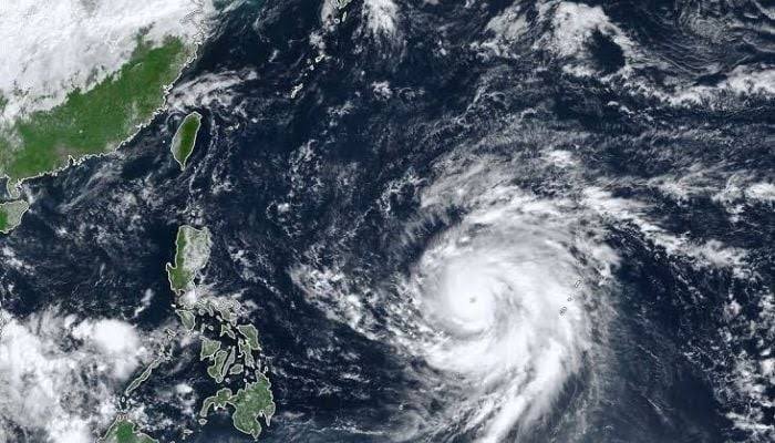
VISAKHAPATNAM, October 28 (Aalimi Nation) – Very severe cyclonic storm Arnab began crossing the Andhra Pradesh coast early on Wednesday, bringing strong winds and heavy rain to the Kakinada and Yanam areas after authorities moved tens of thousands of people to relief shelters. The Cyclone Arnab landfall started around 1:20 am, the India Meteorological Department said.
Landfall earlier than forecast
The weather department said the crossing began near Kakinada along the coasts of Andhra Pradesh and Yanam, and was expected to continue until about 4 am. The storm moved faster than forecast, bringing landfall forward from the forenoon timing predicted on Tuesday evening.
Maximum sustained winds were 125 to 135 km/h, with gusts up to 150 km/h, the department said. Heavy to extremely heavy rain was recorded at 161 locations in Andhra Pradesh, and officials said rain and strong winds are likely to continue even after the landfall process ends.
Damage and disruption
Strong winds uprooted trees and damaged local infrastructure, according to officials. National Highway 216 was blocked near the Yanam entrance. Full damage assessments had not been released.
The Ministry of Civil Aviation held an emergency review meeting. At least 21 flights were cancelled at the Vijayawada and Visakhapatnam airports, while services at Bhubaneswar, Hyderabad and parts of neighbouring states faced heavy delays. Indian Railways cancelled at least 50 trains on the coastal corridor.
Evacuations in two states
Andhra Pradesh has moved 84,396 people into 290 relief shelters, officials said. Chief Minister N. Chandrababu Naidu said 2,199 shelters had been designated across the state, with priority for vulnerable groups. In Odisha, schools have been closed in 16 of the state's 30 districts and thousands of shelters have been kept ready, as southern parts of the state face heavy rain and wind from the system's outer bands. Officials have said around 48,000 people in Odisha were being evacuated.
The Indian Navy, the Coast Guard and national and state disaster response forces are on high alert, the authorities said. Officials have urged residents of affected coastal areas to "stay indoors until the storm completely passes" and to postpone travel.
What forecasters had warned
Before landfall, the weather department had warned of a storm surge of about 2.5 metres above the astronomical tide, which could flood low-lying coastal areas, especially around Kakinada. A red warning for extremely heavy rain was in force for coastal Andhra Pradesh, Odisha and Chhattisgarh for Wednesday, and the Union Home Ministry had asked 14 states and Union Territories to monitor the situation and take precautionary measures.
What happens next
Authorities are expected to keep shelters open until the winds subside and then assess damage to houses, power lines, roads and standing crops. Officials have not said when flights and trains will resume normal schedules. Updated evacuation and damage figures from the Andhra Pradesh and Odisha governments are expected later in the day, and the weather department is expected to issue further bulletins as the system weakens over land.