
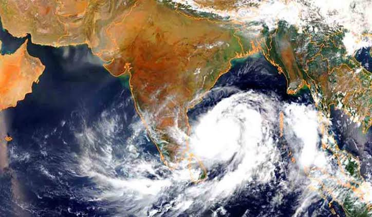
NEW DELHI, November 17 (Aalimi Nation) – Cyclonic storm Akvan over the Bay of Bengal is forecast to strengthen into a very severe cyclonic storm and cross the Andhra Pradesh coast around noon on Friday, November 20, the India Meteorological Department (IMD) said, with warnings now in place for several coastal districts.
What the forecast says
The IMD said the system intensified from a depression into a cyclonic storm on the evening of November 16 and was centred about 610 km east of Chennai at that time. It is expected to move north-northwestwards, becoming a severe cyclonic storm by Tuesday evening and a very severe cyclonic storm by Thursday.
IMD Director General Mrityunjay Mohapatra said the storm is likely to cross the Andhra Pradesh coast between Nellore and Tuni. Wind speeds at landfall are expected to be 120 to 130 km/h, gusting up to 145 km/h. The stretch of coast covers roughly 500 km, and the department said later bulletins would narrow the landfall area. It described the confidence in its track and intensity forecast as moderate to high.
Warnings and likely impact
The IMD has warned of gales along the Andhra Pradesh coast from the evening of November 18, with winds of 120 to 130 km/h from the night of November 19 until landfall. Peak impact is expected from Thursday night to Friday afternoon. The department said the storm could cause extensive damage in coastal Andhra Pradesh, including to thatched and tin-roofed houses, and could uproot trees and bring down electricity and telephone poles.
For rainfall, the IMD has issued a red alert for extremely heavy rain on November 19 and 20 in Kakinada, Konaseema, East Godavari, West Godavari, Eluru, Krishna, Bapatla and Yanam. An orange alert for heavy to very heavy rain covers Vizianagaram, Visakhapatnam, Anakapalle, Guntur, Prakasam and Nellore. The department also forecast a storm surge of one to two metres above the astronomical tide in low-lying areas of several districts, including Bapatla, Krishna and West Godavari.
Heavy to very heavy rain is expected in north Tamil Nadu, including Chennai, on November 17 to 19, and at isolated places in Odisha from November 19 to 21.
Precautions under way
Fishing has been suspended in the south-west and west-central Bay of Bengal until November 20, and Mohapatra said warnings were being issued to fishermen and fishing officials to stop all fishing activity. The IMD has asked that people living in coastal huts be moved to safer places.
Andhra Pradesh Chief Minister N. Chandrababu Naidu reviewed preparations on November 16, his office said. Odisha has alerted all of its 30 districts, officials said. Tamil Nadu's State Relief Commissioner B. Chandra Mohan asked the public to rely only on bulletins from the IMD and the state disaster management authority.
Forecasts differ outside the IMD
Some private weather commentators have suggested the storm could make landfall further south, between Chennai and Cuddalore. These projections have not been verified. The IMD's regional centre in Chennai said its forecast still points to the Andhra coast, with the storm passing about 150 km offshore from Chennai and its outer bands bringing heavy rain to the city on November 17 and 18.
Residents were urged to follow only official advisories. Emergency helplines include 112 nationwide and 1070 in Andhra Pradesh.